15 49.0138 8.38624 1 1 5000 1 https://www.lukeobrien.com.au 300 true

Mt Wedge & South West Tasmania

Mt Wedge is a great vantage point of all the well known south west Tassie mountains like the Western Arthurs, Federation Peak, Mt Anne, and Lake Pedder and the Florentine Valley, Mt Field and so on.There was a lot of smoke this day which wasn’t real great, and the myrtle forest on the upper slopes of...Read More
cape raoul hike tasman peninsula

Cape Raoul Walk, Tasman Peninsula

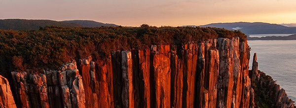
Last week we spent a couple of days doing the Cape Raoul walk on the Tasman Peninsula. The hike is approximately 5 hours return, and is most often done as a return day walk. There is however a very convenient grassed area only about 1 km from the Cape itself which is a great place...Read More

Bay of Fires, North East Tasmania

The Bay of Fires is a fantastic stretch of coast in NE Tas, stretching from the Mt William National Park in the north, down towards Binalong Bay. Here are a few images from a trip I took to the area  around easter 2009. The Bay of Fires is famous for its brilliant blue sea fringed by the lichen...Read More

A Night in the Mountains – Tim Shea

Recently we spent a night on Mt Tim Shea, which is basically at the gateway to the South West, with great views over The Thumbs, the Needles & Mt Field. Tasmania’s South West is a much loved wilderness area which covers approx 20% of Tasmania. South West Tasmania was the very happy hunting ground of two...Read More

Walls of Jerusalem National Park

This month’s featured photos are from the Walls of Jerusalem National Park, part of Tasmania’s spectacular World Heritage Area.   We spent 2 nights in the park recently, and while the lack of scoparia flowers was disappointing, the rugged alpine terrain, misty mountains and ancient groves of pencil pine were very rewarding. The pencil pine...Read More

Tasmania’s Tarkine Wilderness Area

This month I am revisiting some images of Tasmania’s Tarkine wilderness. The Tarkine wilderness is a spectacular, remote and until very recently, quite unknown part of Tasmania. Even today there is some ambiguity about the region. There is no formal boundary or defined area called the Tarkine on official maps, however, conservationists opposed to industrial...Read More

Tassie’s North Coast

Over the past few weeks I have been spending some time on the north coast of Tas, in the Georgetown area. There is a combination of dramatic beaches full of jagged rocks and vivid red and yellow lichens; and peaceful sandy beaches stretching for miles along the coast. Unfortunately there was also a big fire burning...Read More

Tasmanian photography locations: Cradle Mountain

Cradle Mountain is perhaps the best know Tasmanian photography locations and the beloved symbol of the Tasmanian Wilderness. It is the most well known and most visited part of Tasmania, and a highlight of any Tasmanian photography trip. Dove Lake is at around 900m altitude, and the peak of Cradle Mountain is over 1500m. Walks range...Read More

Japan 2009

Back in Tas, 5 weeks in Japan has come and gone…As well as our personal travels, there were quite a few news stories that made the trip interesting – firstly, the great Momo (peach) crisis of 2009 in Fukushima. The rainy season basically didn’t end this year, and summer was “cancelled” in northern Japan. This meant...Read More

A Walk in the Mountains

Okunikkawa is a great little ravine, of fast flowing river rapids and waterfalls deep in the mountains between Sendai and Yamagata in northern Honshuu. We copped a heap of rain, but still managed to sneak in a few pics:  
BOOK NOW